

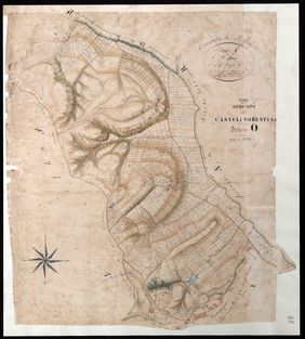
Grazie all'Istituto centrale per la digitalizzazione del patrimonio culturale – Digital Library del Ministero della Cultura, che ha redatto e coordinato i progetti PND/PNRR dedicati alla documentazione catastale, il solo cantiere dell'Archivio di Stato di Firenze ha già prodotto circa 1.300.000 immagini digitali - tra cui circa 40.000 documenti grafici catastali e mappe - e oltre 48.000 schede descrittive, portando a compimento con successo il progetto.
Parallelamente, anche gli altri Archivi di Stato della Toscana sono impegnati nell'attuazione di significativi interventi di digitalizzazione della documentazione catastale conservata presso i rispettivi istituti.
In questa nuova fase del progetto (Fase 3), la piattaforma Ca.Sto.Re. (Catasti Storici Regionali) sarà ulteriormente sviluppata e arricchita con le nuove digitalizzazioni realizzate dagli archivi toscani, al fine di mettere in relazione le mappe storiche georeferenziate con il territorio contemporaneo. Gli obiettivi dell’iniziativa sono documentare l’evoluzione della conoscenza del territorio regionale a partire dai catasti geometrico-particellari dell’Ottocento e promuovere una più approfondita comprensione delle strutture territoriali e paesaggistiche nella loro dimensione storica, a supporto delle attività di pianificazione e governo del territorio.
“L’Archivio di Stato di Firenze - dichiara la Direttrice dell’Archivio di Stato di Firenze Paola d'Orsi - ha contribuito in modo determinante al raggiungimento di questi risultati, mettendo a disposizione competenze archivistiche, risorse e un costante impegno nella descrizione e valorizzazione della documentazione catastale. La digitalizzazione e l’organizzazione di un patrimonio così vasto rappresentano un passaggio fondamentale per rendere queste fonti più accessibili agli studiosi, alle istituzioni e ai cittadini, favorendo nuove prospettive di ricerca e una più ampia conoscenza della storia del territorio: una base fondamentale per la nuova fase del progetto Ca.Sto.Re.”
“I risultati conseguiti dall’Archivio di Stato di Firenze danno la misura del lavoro svolto e dell’impegno degli Archivi di Stato nella digitalizzazione del patrimonio catastale – dichiara Antonio Tarasco, Direttore generale Archivi del Ministero della Cultura –. Con questo accordo, la Direzione generale Archivi intende dare continuità al lavoro degli istituti toscani e favorire l’integrazione dei nuovi materiali nella piattaforma CA.STO.RE. La collaborazione con la Regione Toscana e le Università di Firenze, Pisa e Siena permetterà di affiancare alle competenze archivistiche quelle cartografiche e scientifiche, ampliando le possibilità di studio della documentazione e la sua utilità per la conoscenza e la gestione del territorio”.
CA.STO.RE enters phase 3: agreement signed for Tuscany’s historical land registers
Florence, 2 October 2026 – A new agreement aimed at promoting analysis, research, scientific development and the enhancement of the documentary heritage of the nineteenth-century land registers held in the Tuscan State Archives has been signed by the Director-General of the Archives, Antonio Tarasco, the Region of Tuscany and the Universities of Florence, Pisa and Siena.
Thanks to the Central Institute for the Digitisation of Cultural Heritage – Digital Library of the Ministry of Culture, which drafted and coordinated the PND/PNRR projects dedicated to cadastral documentation, the project at the State Archives of Florence alone has already produced around 1,300,000 digital images – including some 40,000 cadastral drawings and maps – and over 48,000 descriptive records, bringing the project to a successful conclusion.
At the same time, the other State Archives in Tuscany are also engaged in carrying out significant digitisation projects involving the cadastral records held at their respective institutions.
In this new phase of the project (Phase 3), the Ca.Sto.Re. platform (Regional Historical Cadastral Records) will be further developed and enriched with the new digitised material produced by the Tuscan archives, with a view to linking the georeferenced historical maps to the contemporary territory. The objectives of the initiative are to document the evolution of knowledge of the regional territory, starting with the 19th-century geometric and parcel-based cadastral registers, and to promote a deeper understanding of territorial and landscape structures in their historical context, in support of land-use planning and governance activities.
“The State Archives of Florence,” says Paola d’Orsi, Director of the State Archives of Florence, “have made a decisive contribution to achieving these results, providing archival expertise, resources and a constant commitment to the description and promotion of the cadastral records. The digitisation and organisation of such a vast collection represent a crucial step towards making these sources more accessible to scholars, institutions and the public, fostering new avenues of research and a broader understanding of the region’s history: a fundamental foundation for the next phase of the Ca.Sto.Re project.”
“The results achieved by the State Archives of Florence demonstrate the scale of the work carried out and the commitment of the State Archives to the digitisation of the cadastral heritage,” said Antonio Tarasco, Director-General of Archives at the Ministry of Culture. “Through this agreement, the Directorate-General for Archives aims to ensure the continuity of the work carried out by the Tuscan institutions and to facilitate the integration of the new materials into the CA.STO.RE. platform. The collaboration with the Region of Tuscany and the Universities of Florence, Pisa and Siena will make it possible to combine archival expertise with cartographic and scientific skills, broadening the scope for studying the documentation and its usefulness for understanding and managing the territory.”
 |
|---|

